
The epzik8 Webpage
Maryland Route 30 north

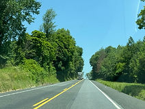
In historic downtown Reisterstown, Maryland, Maryland Route 30 (Hanover Pike) begins at Maryland Route 140 (Reisterstown Road) and proceeds through the north side of the community. Photo taken 06-23-2025.

The first northbound MD 30 reassurance shield is on the right. Photo taken 06-23-2025.

As it nears a hillcrest, MD 30 approaches a junction with Maryland Route 128 (Butler Road). Photo taken 06-23-2025.

MD 128 goes from here several miles east to Falls Road (MD 25) at the community of Butler. Photo taken 06-23-2025.

To the left, a connector road, Maryland Route 795, leads southward to Interstate 795 (Northwest Expressway), which links Reisterstown and Owings Mills to Interstate 695 (Baltimore Beltway) in Pikesville as it parallels MD 140. Photo taken 06-23-2025.

After MD 128, Old Hanover Road, a historic alignment of MD 30, begins paralleling MD 30. Photo taken 06-23-2025.

The southbound end of Old Hanover, at right, intersects MD 30 perpendicularly. Photo taken 06-23-2025.

Now out of Reisterstown proper, MD 30 passes through a cluster of trees. Photo taken 06-23-2025.

A connector to Old Hanover is intersected at right. Photo taken 06-23-2025.

Then, the highway crosses a branch of the historic Baltimore and Hanover Railroad that goes west to Westminster and beyond. Photo taken 06-23-2025.

After going downhill, the route intersects Kemp Road. Photo taken 06-23-2025.
The route then goes back uphill as the trees disperse slightly. Photo taken 06-23-2025.

At another hillcrest, MD 30 intersects the north end of the southern section of Old Hanover. Photo taken 06-23-2025.

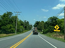
The next 6 miles of MD 30 are a deer crossing area. Photo taken 06-23-2025.

At left, the route intersects Weywood Drive, a residential street. Photo taken 06-23-2025.

Dipping downward, the route begins paralleling an old railroad track seen at right. Photo taken 06-23-2025.

At a signal up ahead, Rue St. Lo Drive leads into the Maryland National Guard's Camp Fretterd. Photo taken 06-23-2025.

A few feet past the signal, the railroad track curves off to the right. Photo taken 06-23-2025.

Glen Falls Road (left) and another segment of Old Hanover Road (right) are intersected ahead. Photo taken 06-23-2025.

After those intersections, MD 30 goes downhill past a field and toward more trees. Photo taken 06-23-2025.

Ahead, MD 30 intersects Mount Gilead Road at a blind spot, hence the flashers on this sign. Photo taken 06-23-2025.

The road then dips downward before curving left. Photo taken 06-23-2025.

The route proceeds downhill through still more trees. Photo taken 06-23-2025.

It then levels off and goes past another field. Photo taken 06-23-2025.

Up ahead, the speed limit drops to 40 miles per hour. Photo taken 06-23-2025.

As the highway approaches the community of Fowblesburg, the elevation fluctuates a couple more times. Photo taken 06-23-2025.

The route climbs uphill and nears a traffic signal at Maryland Route 91 (Emory Road). Photo taken 06-23-2025.

Hanover, Pennsylvania and Hampstead are both marked as being straight ahead at this junction. Photo taken 06-23-2025.

MD 91 goes southwest from here to Maryland Route 32 at Gamber in Carroll County. Photo taken 06-23-2025.

After MD 91, MD 30 has another intersection with Old Hanover Road. Photo taken 06-23-2025.

It then comes time for MD 30 reassurance. Photo taken 06-23-2025.

A driveway just further along then has its own advance signage. Photo taken 06-23-2025.

After a righthand curve, the highway climbs slowly uphill once again. Photo taken 06-23-2025.

Near the top of the hill, MD 30 prepares to intersect Fringer Road beside the Upperco Volunteer Fire Company. Photo taken 06-23-2025.

Next, there is a crossroads at Dover Road (right) and Bortner Road (left). Photo taken 06-23-2025.

That intersection is augmented by a flashing beacon. Photo taken 06-23-2025.
MD 30 next intersects Arcadia Avenue. Photo taken 06-23-2025.

Afterward, the route eases upward past a field and trees, and there is another MD 30 reassurance shield. Photo taken 06-23-2025.

At left, there is a somewhat obscured intersection with Lees Mill Road. Photo taken 06-23-2025.

Soon afterward, MD 30 leaves Baltimore County for Carroll County. Photo taken 06-23-2025.

In half a mile, mainline MD 30 will intersect the south end of Maryland Route 30 Business, its old alignment through the town of Hampstead. Photo taken 06-23-2025.

Large trucks are prohibited within Hampstead and must use the mainline bypass to the west. Photo taken 06-23-2025.

The business/bypass split contains a roundabout. Photo taken 06-23-2025.

Mainline MD 30 now has a control city of Manchester. Meanwhile, Phillips Drive, which leads to Wolf Hill Drive, is intersected at the roundabout. Photo taken 06-23-2025.

This roundabout is two lanes wide with either lane being permitted for through movements on MD 30 north. Photo taken 06-23-2025.

MD 30 Bus. now bears off to the right to Hampstead. Photo taken 06-23-2025.

Mainline MD 30 then bears onto the Hampstead Bypass. Photo taken 06-23-2025.

Decades in the making, the Hampstead Bypass finally opened in 2009, reducing congestion in Hampstead and removing truck traffic from the town. Photo taken 06-23-2025.

There is MD 30 reassurance at the start of the bypass. Photo taken 06-23-2025.

Manchester and Hanover are a respective 6 and 17 miles away. Photo taken 06-23-2025.

The route proceeds to curve wide right. Photo taken 06-23-2025.

The highway straightens out, then passes under Houcksville Road. Photo taken 06-23-2025.

Just further along, a sound barrier lines the left side of the highway. Photo taken 06-23-2025.

It then crosses Shiloh Road. Photo taken 06-23-2025.

A few feet to the north, there is a bridge over Indian Run. Photo taken 06-23-2025.

Half a mile ahead, MD 30 intersects Maryland Route 482 (Hampstead Mexico Road) at a roundabout. Photo taken 06-23-2025.

MD 30 divides again approaching the MD 482 roundabout. Photo taken 06-23-2025.

MD 482 heads west to Carroll County seat Westminster via MD 27. Photo taken 06-23-2025.

MD 482 bears right into Hampstead to the east. Photo taken 06-23-2025.

MD 30 then exits the roundabout. Photo taken 06-23-2025.

Manchester and Hanover are now 3 and 14 miles away. Photo taken 06-23-2025.

The route proceeds to curve wide to the left. Photo taken 06-23-2025.

After a few tenths of a mile, it straightens out. Photo taken 06-23-2025.

Next, it crosses a tributary of the East Branch. Photo taken 06-23-2025.

One more roundabout awaits at the end of the bypass. Photo taken 06-23-2025.

At this roundabout, mainline MD 30 receives the north end of its business route. Photo taken 06-23-2025.

This sign points back toward southbound MD 30 Bus. and downtown Hampstead. Photo taken 06-23-2025.

After the bypass ends, MD 30 approaches a traffic signal at Brodbeck Road (left) and Eagle Ridge Court (right). Photo taken 06-23-2025.

This light sits beside the Hampstead Marketplace shopping center. Photo taken 06-23-2025.

As it pulls away from Hampstead, MD 30 prepares to intersect Basler Road. Photo taken 06-23-2025.

Basler Road leads northeast to the residential community of Maple Grove, which sits beside the B&H railroad grade. Photo taken 06-23-2025.

The route proceeds to intersect Cape Horn Road within a righthand curve. Photo taken 06-23-2025.

The highway continues north with a speed of 45 miles per hour. Photo taken 06-23-2025.

MD 30 starts to go downhill and intersects Charmil Drive. Photo taken 06-23-2025.

It will then intersect Maple Grove Road at a traffic signal. Photo taken 06-23-2025.

Maple Grove Road leads back to Basler Road to the northeast. Photo taken 06-23-2025.

It then comes time for MD 30 reassurance. Photo taken 06-23-2025.

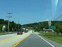
The route soon enters the city of Manchester. Photo taken 06-23-2025.

Entering Manchester, the speed limit drops to 30 miles per hour. Photo taken 06-23-2025.

At the top of a hill, MD 30 intersects Beaver Street to the right. Photo taken 06-23-2025.

At a traffic signal, it then intersects Westminster Street (left) and York Street (right). Photo taken 06-23-2025.

There is a marker afterward stating this is part of the Mason and Dixon Scenic Byway. Photo taken 06-23-2025.

Up ahead, MD 30 will intersect the northern end of Maryland Route 27. Photo taken 06-23-2025.

MD 27 runs 39 miles southwest to Germantown in Montgomery County by way of Westminster, Mount Airy and Damascus. For most of its length, it follows Parr's Ridge, the most geographically prominent feature of Maryland's Piedmont, and is named Ridge Road in reference to it. Photo taken 06-23-2025.

On that note, MD 30 heads out of Manchester. Photo taken 06-23-2025.

Hanover now lies 11 miles away. Photo taken 06-23-2025.

Michelle Road (left) and Ferrier Road (right) are intersected straight ahead. Photo taken 06-23-2025.

The route goes slightly uphill just before a curve to the right. Photo taken 06-23-2025.

A left turn at the signal ahead leads toward Fridinger Mill Road. Photo taken 06-23-2025.

The signal itself is at Hallie Avenue. Photo taken 06-23-2025.

After Hallie Avenue, MD 30 will meet the south end of Maryland Route 86. Photo taken 06-23-2025.

The community of Lineboro is along MD 86's path. Photo taken 06-23-2025.

MD 86 (Lineboro Road) runs 4 miles northeast into Manheim Township, Pennsylvania, where it becomes Pennsylvania Route 516. Photo taken 06-23-2025.

After MD 86, MD 30 climbs the Dug Hill Ridge. The highest point in Maryland's Piedmont (approximately 1,100 feet) is along this ridge a distance to the west. Photo taken 06-23-2025.

Before a lefthand curve, the highway intersects Manchester Baptist Church Road. Photo taken 06-23-2025.

At the top of the ridge, the route meets Ebbvale Road. Photo taken 06-23-2025.

The speed limit soon drops to 40. Photo taken 06-23-2025.

Going downhill, MD 30 approaches Traceys Mill Road. Photo taken 06-23-2025.

The road straightens out before climbing slightly back uphill. Photo taken 06-23-2025.
Soon, it comes upon a signal at Maryland Route 496 (Bachmans Valley Road) and Wentz Road. Photo taken 06-23-2025.

MD 496 heads several miles southwest to MD 97 north of Westminster. Photo taken 06-23-2025.

There is MD 30 reassurance as the route climbs further uphill. Photo taken 06-23-2025.

Hanover is now just 8 miles away. Photo taken 06-23-2025.

After leveling off again, the route comes upon Deep Run Road. Photo taken 06-23-2025.

A little further along, it intersects the archaically named Mount Ventus Road No. 1. Photo taken 06-23-2025.

The route then meets Harvey Yingling Road at left. Photo taken 06-23-2025.

The highway curves right out of the trees before curving left. Photo taken 06-23-2025.

At right, there is an intersection with Scenic View Drive. Photo taken 06-23-2025.

The last intersection in Maryland is at Mount Ventus Road No. 2. Photo taken 06-23-2025.

As the route crosses the state line, there is a marker spotlighting the Mason-Dixon Line. Photo taken 06-23-2025.

The highway is now in West Manheim Township, York County, Pennsylvania and transitions from MD 30 into Pennsylvania Route 94, continuing toward Hanover. Photo taken 06-23-2025.